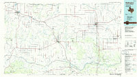
1986 Map of Wellington
USGS Topo · Published 1986About this map
The Salt Fork Red River and its numerous tributaries, such as Lelia Lake Creek and Buck Creek, define the drainage patterns of this Texas Panhandle landscape in the mid-1980s. Agricultural settlements are concentrated along the Burlington Northern railroad corridor, including the county seats of Clarendon and Memphis. Significant water features like Greenbelt Reservoir and Lelia Lake stand out against the surrounding ranch land and dissected terrain. Smaller rural communities like Quail, Arlie, and Mc Knight reflect the dispersed population centers typical of Collingsworth and Donley counties. Local aviation is supported by the Municipal Airport at Clarendon and the Marian Airpark further east. Genealogy researchers may find interest in landmarks such as the Citizens Cem or the smaller rural crossings like Parnell and Giles, which illustrate the enduring footprint of early cattle and rail expansion in the region.
Find a feature on this map
109 named features on this map. Tap any name to fly to it.
Don’t see what you’re looking for? This feature index may not catch every label — zoom into the map to look around manually.
Map Details
Editions of this 1986 Wellington Map
2 editions found
Other maps of this area

1954 · Amarillo
USGS Topo · 1:250,000

1954 · Plainview
USGS Topo · 1:250,000

1955 · Lawton
USGS Topo · 1:250,000

1955 · Clinton
USGS Topo · 1:250,000

1957 · Clinton
USGS Topo · 1:250,000

1958 · Amarillo
USGS Topo · 1:250,000

1958 · Plainview
USGS Topo · 1:250,000

1959 · Lelia Lake Creek
USGS Topo · 1:24,000

1959 · Wellington NW
USGS Topo · 1:24,000

1959 · Troublesome Creek
USGS Topo · 1:24,000