
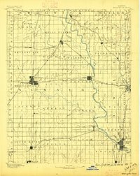
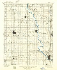
1890 Map of Wellington
USGS Topo · Published 1890About this map
Wellington stands at the heart of this late-nineteenth-century survey, serving as a critical junction for the Chicago Kansas and Western Railroad and the Atchison Topeka and Santa Fe Railroad. The landscape is defined by the sweeping course of the Arkansas River, which flows past the growing river towns of Oxford and Arkansas City. To the west, the prairie is marked by numerous watercourses such as Shoo Fly Creek and Fly Creek, while the southern border shows the border town of Hunnewell on the edge of the Indian Territory. The settlement pattern reveals the rapid expansion of the era, from the mineral springs at Geuda Springs to established rail stops like Belle Plaine and Winfield. This detailed topography, surveyed in 1887, documents the grid-like township divisions that shaped the development of Sumner and Cowley counties.
Find a feature on this map
90 named features on this map. Tap any name to fly to it.
Don’t see what you’re looking for? This feature index may not catch every label — zoom into the map to look around manually.
Map Details
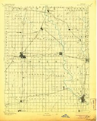
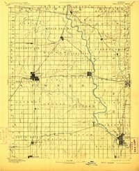
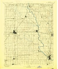
Editions of this 1890 Wellington Map
6 editions found
Other maps of this area

1888 · Eldorado
USGS Topo · 1:125,000

1889 · Burden
USGS Topo · 1:125,000

1889 · Cheney
USGS Topo · 1:125,000

1889 · Wichita
USGS Topo · 1:125,000

1889 · Caldwell
USGS Topo · 1:125,000

1891 · Cheney
USGS Topo · 1:125,000

1893 · Caldwell
USGS Topo · 1:125,000

1894 · Wichita
USGS Topo · 1:125,000
1897 · Caldwell
USGS Topo · 1:125,000

1901 · Cheney
USGS Topo · 1:125,000