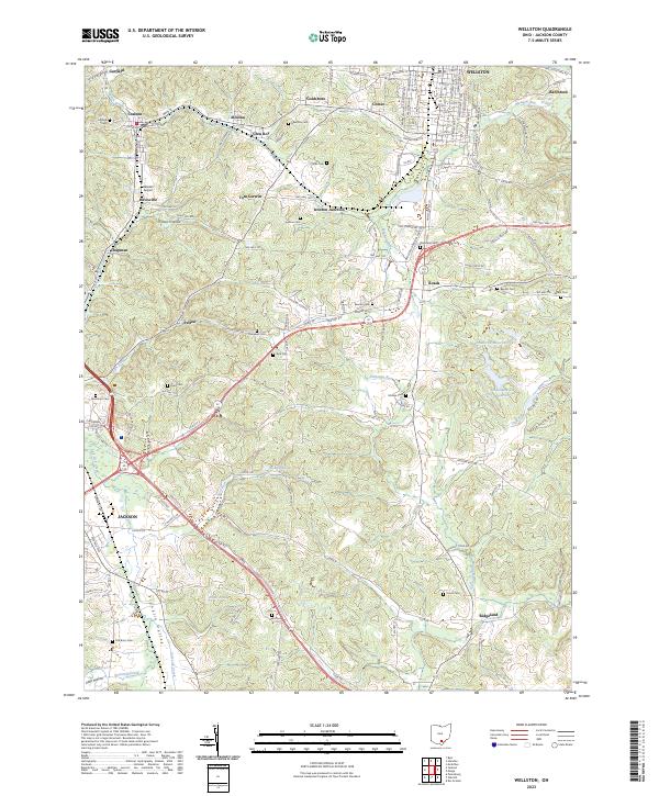
2023 Map of Wellston
USGS Topo · Published 2023About this map
Wellston and Jackson anchor this contemporary mapping of Jackson County, showcasing a landscape where historical coal-mining settlements have evolved into modern residential and industrial hubs. Small hamlets like Coalton, Glen Roy, and Goldsboro dot the northern reaches, connected by a network of rural roads such as Hard Scrapple Rd and Number 8 Pike. The terrain is defined by a series of north-south drainages including Pigeon Creek, Licks Run, and Sugar Run, which carve through the ridges and valleys of the Franklin Valley and Hothouse Ridge. Genealogists will find this sheet particularly valuable for its high density of rural burial grounds, ranging from the Coalton Cem near the northern border to the Old Bunn Cem in the south, preserving the names of the families who settled these hollows.
Find a feature on this map
137 named features on this map. Tap any name to fly to it.
Don’t see what you’re looking for? This feature index may not catch every label — zoom into the map to look around manually.
Map Details
Editions of this 2023 Wellston Map
This is the sole edition of this map. No revisions or reprints were ever made.
Other maps of this area

1905 · Wilkesville
USGS Topo · 1:62,500

1906 · Bidwell
USGS Topo · 1:62,500

1908 · Bidwell
USGS Topo · 1:62,500

1908 · Wilkesville
USGS Topo · 1:62,500

1912 · Oak Hill
USGS Topo · 1:62,500

1913 · Jackson
USGS Topo · 1:62,500

1944 · Jackson
USGS Topo · 1:62,500

1947 · Columbus
USGS Topo · 1:250,000

1957 · Huntington
USGS Topo · 1:250,000

1960 · Huntington
USGS Topo · 1:250,000