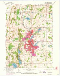
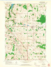
1959 Map of West Bend
USGS Topo · Published 1972About this map
The Milwaukee River meanders through the heart of Washington County, anchoring the urban center of West Bend and the northern settlement of Barton. During this mid-century period, the area exhibits a transition from its industrial and milling roots at Young America to post-war residential expansion, noted by the purple-shaded growth reaching toward Silver Lake and Lucas Lake. The Chicago and North Western railroad provides a vertical axis for the town, passing by numerous Gravel Pits that suggest a landscape defined by glacial deposits. This geology is further preserved in the Kettle Moraine State Forest and the archaeological site at Lizard Mound State Park. Educational and religious life is well-documented through several parochial institutions like Old St Marys Ch and Holy Angels Sch, while the County Hospital and its associated County Hospital Cem reflect the region's public infrastructure.
Find a feature on this map
66 named features on this map. Tap any name to fly to it.
Don’t see what you’re looking for? This feature index may not catch every label — zoom into the map to look around manually.
Map Details
Editions of this 1959 West Bend Map
4 editions found

Other maps of this area

1904 · West Bend
USGS Topo · 1:62,500

1904 · Hartford
USGS Topo · 1:62,500

1955 · Campbellsport
USGS Topo · 1:62,500

1955 · Kewaskum
USGS Topo · 1:62,500

1957 · Madison
USGS Topo · 1:250,000

1959 · West Bend
USGS Topo · 1:62,500

1959 · Hartford
USGS Topo · 1:62,500

1959 · Allenton
USGS Topo · 1:24,000
1959 · Newburg
USGS Topo · 1:24,000
1959 · Jackson
USGS Topo · 1:24,000