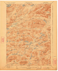
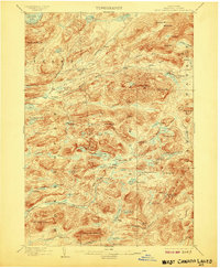
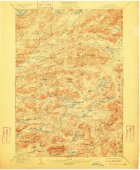
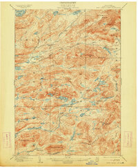
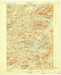
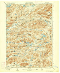
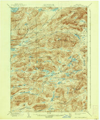
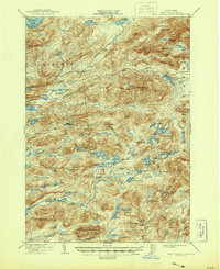
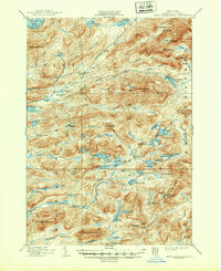
1903 Map of West Canada Lakes
USGS Topo · Published 1923About this map
The Totten and Crossfield Line cuts through this high Adirondack wilderness, marking a historical boundary between the townships of Arietta, Inlet, and Indian Lake. Surveyed at the end of the 19th century, the landscape is defined by an intricate network of waterways including the South Branch Moose River and the Stillwater River. Human presence is sparse, limited to remote outposts like Kenwells and several backcountry locations such as Millers Camp and Pillsbury Lake Camp.
Find a feature on this map
83 named features on this map. Tap any name to fly to it.
Don’t see what you’re looking for? This feature index may not catch every label — zoom into the map to look around manually.
Map Details
Editions of this 1903 West Canada Lakes Map
10 editions found
Other maps of this area

1899 · Indian Lake
USGS Topo · 1:62,500

1900 · Canada Lake
USGS Topo · 1:62,500

1900 · Wilmurt
USGS Topo · 1:62,500

1901 · Old Forge
USGS Topo · 1:62,500

1902 · Wilmurt
USGS Topo · 1:62,500

1902 · Indian Lake
USGS Topo · 1:62,500

1903 · Big Moose
USGS Topo · 1:62,500

1903 · West Canada Lakes
USGS Topo · 1:62,500

1903 · Raquette Lake
USGS Topo · 1:62,500

1903 · Blue Mountain
USGS Topo · 1:62,500