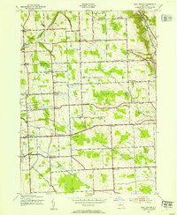
1943 Map of West Groton
USGS Topo · Published 1966About this map
The rural landscapes of Lansing and Groton were documented during World War II, revealing a dense network of crossroads settlements and small schoolhouses that defined central New York during this era. The map shows a transition from the agricultural plateaus of Bone Plains and Bean Hill down toward the steep valley of the Owasco Inlet. Genealogists will find significant value in the distribution of family-named corners such as Howser Corner, Munson Corners, and Van Ostrand Corner, alongside several distinct burial grounds like Stearns Cem and Lanterman Cem. A rare Grotto and a Gas Well near Terpening Corners indicate the specialized landmarks and early industrial efforts scattered among the upland farms. The prevalence of numbered schoolhouses, from School No 5 to School No 22, reflects the district-school system still intact before mid-century consolidation.
Find a feature on this map
80 named features on this map. Tap any name to fly to it.
Don’t see what you’re looking for? This feature index may not catch every label — zoom into the map to look around manually.
Map Details
Editions of this 1943 West Groton Map
3 editions found

Other maps of this area

1893 · Ithaca
USGS Topo · 1:62,500

1895 · Ithaca
USGS Topo · 1:62,500

1898 · Moravia
USGS Topo · 1:62,500

1900 · Dryden
USGS Topo · 1:62,500

1902 · Moravia
USGS Topo · 1:62,500

1902 · Genoa
USGS Topo · 1:62,500

1905 · Watkins Glen
USGS Topo · 1:125,000

1906 · Catatonk
USGS Topo · 1:125,000

1942 · Ludlowville
USGS Topo · 1:24,000

1942 · Groton
USGS Topo · 1:24,000