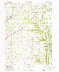
1961 Map of West Salem
USGS Topo · Published 1962About this map
West Salem and Burbank anchor this 1961 survey of the rural landscape where the South Boundary Congress Lands meet the Connecticut Western Reserve. This intersection of historic land grants is reflected in the rigid grid of fields and farmsteads, many of which are specifically identified by fine dashed lines from aerial photogrammetry. The rail infrastructure of the Erie-Lackawanna and Baltimore and Ohio railroads defines the corridor between settlements like Aukerman and Congress, while smaller hamlets such as Pleasant Home and Lattasburg dot the countryside.
Find a feature on this map
47 named features on this map. Tap any name to fly to it.
Don’t see what you’re looking for? This feature index may not catch every label — zoom into the map to look around manually.
Map Details
Editions of this 1961 West Salem Map
2 editions found
Other maps of this area

1901 · Wooster
USGS Topo · 1:62,500

1903 · Wooster
USGS Topo · 1:62,500

1904 · Medina
USGS Topo · 1:62,500

1904 · Wellington
USGS Topo · 1:62,500

1906 · Medina
USGS Topo · 1:62,500

1906 · Wellington
USGS Topo · 1:62,500

1906 · West Salem
USGS Topo · 1:62,500

1908 · West Salem
USGS Topo · 1:62,500

1950 · Cleveland
USGS Topo · 1:250,000

1950 · Marion
USGS Topo · 1:250,000