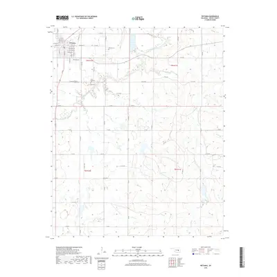
2018 Map of Wetumka
USGS Topo · Published 2018About this map
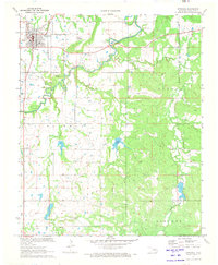
Wetumka serves as the primary hub of this eastern Oklahoma survey, revealing a town layout defined by historic street names such as E Frisco Ave and E Saint Louis Ave. For family historians and genealogists, the landscape is marked by several burial grounds situated outside the main town center, including the Wetumka Cem, Wetumka Baptist Cem, and South Community Cem, along with the more secluded Barnett Cem. The terrain is drained by a network of waterways like Wewoka Creek and Fish Cr, which carve through the rural sections of Hughes County. Petes Airpark provides a local aviation landmark just south of the municipal limits, while the grid of section roads like N S 382 Rd and E 125 Rd illustrates the enduring rural infrastructure of the region.
Find a feature on this map
51 named features on this map. Tap any name to fly to it.
Don’t see what you’re looking for? This feature index may not catch every label — zoom into the map to look around manually.
Map Details
Editions of this 2018 Wetumka Map
This is the sole edition of this map. No revisions or reprints were ever made.
Other maps of this area

1900 · Wewoka
USGS Topo · 1:125,000

1954 · Oklahoma City
USGS Topo · 1:250,000

1957 · Oklahoma City
USGS Topo · 1:250,000

1963 · Oklahoma City
USGS Topo · 1:250,000

1967 · Okemah SE
USGS Topo · 1:24,000

1967 · Weleetka
USGS Topo · 1:24,000
1967 · Dustin
USGS Topo · 1:24,000
1970 · Lamar
USGS Topo · 1:24,000
1971 · Wetumka SE
USGS Topo · 1:24,000
1971 · Wetumka
USGS Topo · 1:24,000