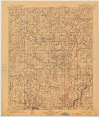
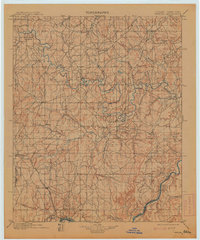
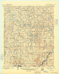
1900 Map of Wewoka
USGS Topo · Published 1925About this map
The tribal lands of the Seminole Nation and Creek Nation are documented here during the late 19th-century transition within Indian Territory. Centered on the meandering path of the North Fork Canadian River, the landscape is defined by the early development of Wewoka and Holdenville. The map captures a moment of settlement patterns established before Oklahoma achieved statehood, showing early infrastructure like Marks Store and religious and educational centers including the Baptist Mission near Wetumka and another Mission further west.
Find a feature on this map
60 named features on this map. Tap any name to fly to it.
Don’t see what you’re looking for? This feature index may not catch every label — zoom into the map to look around manually.
Map Details
Editions of this 1900 Wewoka Map
4 editions found

Historical Maps of Holdenville Through Time
1 maps found