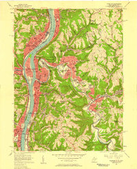
1956 Map of Wheeling
USGS Topo · Published 1958About this map
The Ohio River corridor serves as the industrial and transportation backbone for this mid-1950s landscape, where Wheeling and Martins Ferry face each other across the state line. Heavy rail infrastructure, including the Pennsylvania RR and Baltimore and Ohio RR, hugs the riverbanks, supporting a dense network of neighborhoods like Warwood, Fulton, and Benwood. To the east, the terrain transitions into the steep hollows of Richland and Triadelphia, where Oglebay Park and the Country Club offer sprawling recreational spaces.
Find a feature on this map
102 named features on this map. Tap any name to fly to it.
Don’t see what you’re looking for? This feature index may not catch every label — zoom into the map to look around manually.
Map Details
Editions of this 1956 Wheeling Map
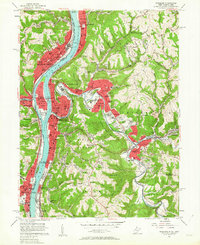
2 editions found
Other maps of this area

1902 · Wheeling
USGS Topo · 1:62,500

1904 · Cameron
USGS Topo · 1:62,500

1905 · Clarington
USGS Topo · 1:62,500

1905 · St. Clairsville
USGS Topo · 1:62,500

1935 · Cameron
USGS Topo · 1:62,500

1935 · Clarington
USGS Topo · 1:62,500

1935 · Wheeling
USGS Topo · 1:62,500

1940 · Clarington
USGS Topo · 1:62,500

1942 · Cameron
USGS Topo · 1:62,500

1942 · Wheeling
USGS Topo · 1:62,500