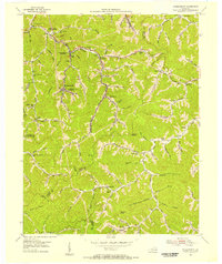
1954 Map of Wheelwright
USGS Topo · Published 1956About this map
The industrial and community layout of the Kentucky coalfields is well-defined here, specifically highlighting the operations and residential hubs of the Wheelwright and Weeksbury districts. Data from coal company maps and mid-century field checks reveal a landscape deeply integrated with the Chesapeake and Ohio railroad, which follows the winding valley of Beaver Creek and its many forks. This era shows a dense network of local education and social infrastructure, including the Dunbar High School and several family-named schoolhouses like the Riley Branch School and Marshall Br School. Beyond the mining settlements of Ligon and Melvin, the terrain rises sharply to named summits like Potatoe Knob and geologic features such as Collier Rocks. The proximity of county lines—including the intersection of Floyd, Knott, and Pike—underscores the complex administrative geography of this central Appalachian region.
Find a feature on this map
95 named features on this map. Tap any name to fly to it.
Don’t see what you’re looking for? This feature index may not catch every label — zoom into the map to look around manually.
Map Details
Editions of this 1954 Wheelwright Map
4 editions found
Other maps of this area

1890 · Whitesburg
USGS Topo · 1:125,000

1892 · Whitesburg
USGS Topo · 1:125,000

1912 · Pound
USGS Topo · 1:48,000

1912 · Hindman
USGS Topo · 1:48,000

1913 · Oven Fork
USGS Topo · 1:48,000

1914 · Pound
USGS Topo · 1:62,500

1914 · Vergie
USGS Topo · 1:48,000

1915 · Hindman
USGS Topo · 1:62,500

1915 · Whitesburg
USGS Topo · 1:62,500

1916 · Pikeville
USGS Topo · 1:62,500