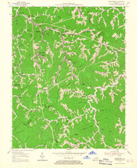
1954 Map of Wheelwright
USGS Topo · Published 1967About this map
Coal country at the intersection of Floyd, Pike, Knott, and Letcher counties is defined by a dense network of hollows and company towns. The Chesapeake and Ohio railroad winds through the valleys, serving significant mountain settlements like Wheelwright and Weeksbury. The landscape is etched with the industrial infrastructure of the era, including a notable Incline near Ligon and several gas wells scattered across the ridges. Educational and community life is centered around local institutions such as Dunbar High Sch and Marshall Br Sch, alongside smaller congregations at Pilgrim Ch and Joppa Ch. This survey, compiled from coal company records and aerial photography, reveals the tight relationship between the narrow bottomlands of Beaver Creek and the steep terrain of Abner Mtn, documenting a period when these isolated mountain passes were bustling centers of Kentucky mining and transit.
Find a feature on this map
100 named features on this map. Tap any name to fly to it.
Don’t see what you’re looking for? This feature index may not catch every label — zoom into the map to look around manually.
Map Details
Editions of this 1954 Wheelwright Map
4 editions found
Other maps of this area

1890 · Whitesburg
USGS Topo · 1:125,000

1892 · Whitesburg
USGS Topo · 1:125,000

1912 · Pound
USGS Topo · 1:48,000

1912 · Hindman
USGS Topo · 1:48,000

1913 · Oven Fork
USGS Topo · 1:48,000

1914 · Pound
USGS Topo · 1:62,500

1914 · Vergie
USGS Topo · 1:48,000

1915 · Hindman
USGS Topo · 1:62,500

1915 · Whitesburg
USGS Topo · 1:62,500

1916 · Pikeville
USGS Topo · 1:62,500