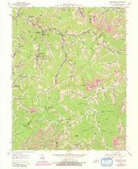
1954 Map of Wheelwright
USGS Topo · Published 1979About this map
The coal-rich valleys of eastern Kentucky define this 1954 survey, centering on the company-built landscape of Wheelwright and neighboring Weeksbury. The industrial footprint is evident in the Chesapeake and Ohio railroad line snaking along Beaver Creek and the numerous strip mines that mark the ridgelines. Community life at mid-century is captured through a high density of rural institutions, from the Dunbar High Sch to the Joppa Ch and Pilgrim Ch.
Find a feature on this map
88 named features on this map. Tap any name to fly to it.
Don’t see what you’re looking for? This feature index may not catch every label — zoom into the map to look around manually.
Map Details
Editions of this 1954 Wheelwright Map
4 editions found
Other maps of this area

1890 · Whitesburg
USGS Topo · 1:125,000

1892 · Whitesburg
USGS Topo · 1:125,000

1912 · Pound
USGS Topo · 1:48,000

1912 · Hindman
USGS Topo · 1:48,000

1913 · Oven Fork
USGS Topo · 1:48,000

1914 · Pound
USGS Topo · 1:62,500

1914 · Vergie
USGS Topo · 1:48,000

1915 · Hindman
USGS Topo · 1:62,500

1915 · Whitesburg
USGS Topo · 1:62,500

1916 · Pikeville
USGS Topo · 1:62,500