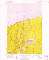
1956 Map of White Pine
USGS Topo · Published 1969About this map
Industrial copper mining operations dominate the landscape south of the Lake Superior shoreline in the mid-1950s. The White Pine Mine is the clear centerpiece, featuring a complex infrastructure that includes a Smoke Stack, Sewage Disposal, and a massive Tailings Pond secured by a Levee. The transport of ore and workers is facilitated by the D S S & A railroad and the M 64 highway, connecting the company town of White Pine to the coastal settlement of Silver City.
Find a feature on this map
35 named features on this map. Tap any name to fly to it.
Don’t see what you’re looking for? This feature index may not catch every label — zoom into the map to look around manually.
Map Details
Editions of this 1956 White Pine Map
3 editions found
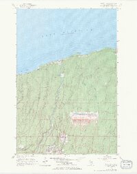
Other maps of this area

1949 · Matchwood NW
USGS Topo · 1:24,000

1949 · White Pine
USGS Topo · 1:24,000

1949 · Bergland NE
USGS Topo · 1:24,000

1955 · Ontonagon
USGS Topo · 1:62,500

1956 · Bergland NE
USGS Topo · 1:24,000

1956 · Bergland
USGS Topo · 1:62,500

1956 · White Pine
USGS Topo · 1:24,000

1956 · Matchwood NW
USGS Topo · 1:24,000

1956 · White Pine
USGS Topo · 1:62,500

1956 · Matchwood
USGS Topo · 1:62,500