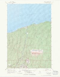
1956 Map of White Pine
USGS Topo · Published 1969About this map
The industrial operations at the White Pine Mine dominate this mid-century survey of the Ontonagon County shoreline. The landscape is defined by the massive Tailings Pond and its associated Levee, connected to the mine works by an Above Ground Pipe Line. This heavy industry sits in sharp contrast to the surrounding natural features, including the eastern reaches of Porcupine Mountains State Park and the Ottawa National Forest.
Find a feature on this map
32 named features on this map. Tap any name to fly to it.
Don’t see what you’re looking for? This feature index may not catch every label — zoom into the map to look around manually.
Map Details
Editions of this 1956 White Pine Map
3 editions found
Other maps of this area

1949 · Matchwood NW
USGS Topo · 1:24,000

1949 · White Pine
USGS Topo · 1:24,000

1949 · Bergland NE
USGS Topo · 1:24,000

1955 · Ontonagon
USGS Topo · 1:62,500

1956 · Bergland NE
USGS Topo · 1:24,000

1956 · Bergland
USGS Topo · 1:62,500

1956 · White Pine
USGS Topo · 1:24,000

1956 · Matchwood NW
USGS Topo · 1:24,000

1956 · White Pine
USGS Topo · 1:62,500

1956 · Matchwood
USGS Topo · 1:62,500