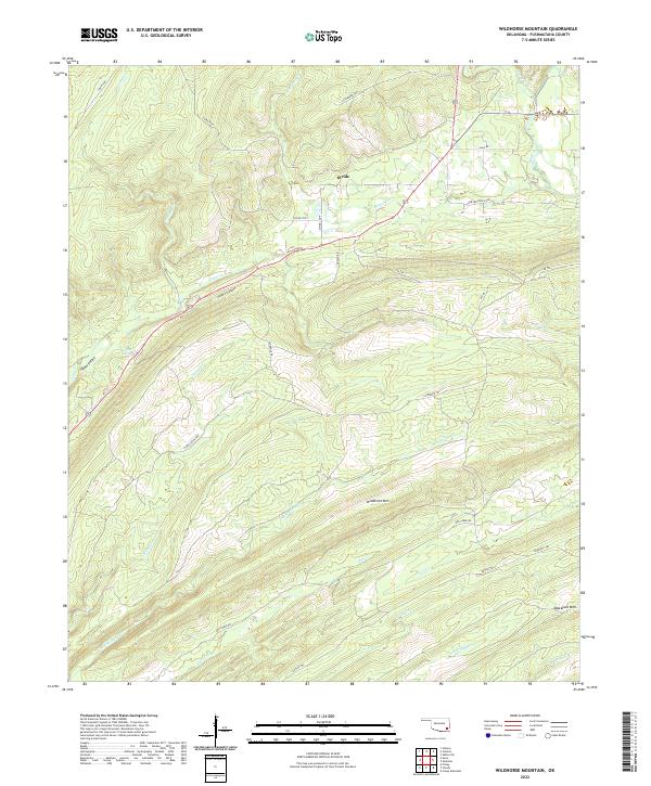
2022 Map of Wildhorse Mountain
USGS Topo · Published 2022About this map
Wildhorse Mtn and Blackjack Mtn anchor the high ground of this interior Pushmataha County landscape, where the terrain is defined by a dense network of watercourses and ridgeline trails. A prominent geographical feature known as the Divide marks the separation of drainage basins, with several branches of One Creek flowing south toward the Kiamichi River system. The presence of Sulphur Spring and Sulphur Canyon suggests a mineral-rich local geology that has long influenced the area's hydrology and land use.
Find a feature on this map
40 named features on this map. Tap any name to fly to it.
Don’t see what you’re looking for? This feature index may not catch every label — zoom into the map to look around manually.
Map Details
Editions of this 2022 Wildhorse Mountain Map
This is the sole edition of this map. No revisions or reprints were ever made.
Other maps of this area

1901 · Tuskahoma
USGS Topo · 1:125,000

1901 · Alikchi
USGS Topo · 1:125,000

1908 · Tuskahoma
USGS Topo · 1:125,000

1909 · Tuskahoma
USGS Topo · 1:125,000

1950 · Mcalester
USGS Topo · 1:250,000

1962 · McAlester
USGS Topo · 1:250,000

1962 · Caney Mountain
USGS Topo · 1:24,000

1965 · McAlester
USGS Topo · 1:250,000
1971 · Clayton
USGS Topo · 1:24,000
1971 · Albion SW
USGS Topo · 1:24,000