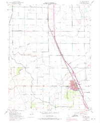
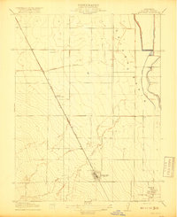
1952 Map of Williams
USGS Topo · Published 1974About this map
The city of Williams sits at a critical junction of the Southern Pacific railroad and regional irrigation systems in this mid-century landscape. To the north, the small railroad stops of Cortena and Delphos align with the tracks, while the vast Colusa Basin dominates the eastern edge of the quadrangle. The map captures the significant role of water management in the Sacramento Valley, illustrated by the massive Glenn - Colusa Canal and several siphons carrying Salt Creek and Freshwater Creek across the agricultural grid.
Find a feature on this map
30 named features on this map. Tap any name to fly to it.
Don’t see what you’re looking for? This feature index may not catch every label — zoom into the map to look around manually.
Map Details
Editions of this 1952 Williams Map
4 editions found
Other maps of this area

1904 · Sites
USGS Topo · 1:24,000

1905 · Fairview
USGS Topo · 1:24,000

1906 · Maxwell
USGS Topo · 1:62,500

1907 · Colusa
USGS Topo · 1:62,500

1917 · Compton Landing
USGS Topo · 1:31,680

1917 · Sites
USGS Topo · 1:31,680

1917 · Delevan
USGS Topo · 1:31,680

1918 · Williams
USGS Topo · 1:31,680

1918 · Spring Valley
USGS Topo · 1:31,680
1918 · Arbuckle
USGS Topo · 1:31,680