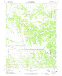
1973 Map of Williamsburg
USGS Topo · Published 1975About this map
Williamsburg and Mineola sit at the intersection of early 1970s transportation and long-standing agricultural tradition in this portion of Callaway and Montgomery Counties. The landscape is dominated by the broad expanse of Nine Mile Prairie, which is dissected by a network of waterways including Bachelor Creek, Whetstone Creek, and the Loutre River. The map reveals a diversified local economy where traditional farming was supplemented by extractive industries, evidenced by numerous Claypits and Quarries scattered across the township lines.
Find a feature on this map
30 named features on this map. Tap any name to fly to it.
Don’t see what you’re looking for? This feature index may not catch every label — zoom into the map to look around manually.
Map Details
Editions of this 1973 Williamsburg Map
2 editions found
Other maps of this area

1890 · Mexico
USGS Topo · 1:125,000

1890 · Fulton
USGS Topo · 1:125,000

1928 · Fulton
USGS Topo · 1:62,500

1931 · Fulton
USGS Topo · 1:62,500

1932 · Mexico
USGS Topo · 1:62,500

1940 · Montgomery City
USGS Topo · 1:62,500

1942 · Montgomery City
USGS Topo · 1:62,500

1942 · Wellsville
USGS Topo · 1:62,500

1948 · Quincy
USGS Topo · 1:250,000

1949 · Saint Louis
USGS Topo · 1:250,000