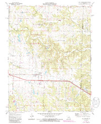
1973 Map of Williamsburg
USGS Topo · Published 1986About this map
Williamsburg and Mineola sit at the center of this landscape where the high plains of Nine Mile Prairie transition into the dissected drainage basins of the Loutre River and Prairie Fork. During the early 1970s, this region of the Callaway and Montgomery county line shows a pattern of agricultural use interspersed with extractive industry, evidenced by numerous Claypits and Quarries scattered near Bachelor Creek and Whetstone Creek. The development of modern infrastructure is marked by the path of Interstate 70, which bypasses the older settlements, while a local Landing Strip and Substation near Williamsburg reflect the era's rural utility. Local heritage is preserved at several points, including High Point Ch and family-named burial grounds such as Augusta Cem and Covington Cem, while the Whetstone Creek State Wildlife Area occupies a significant portion of the northern terrain.
Find a feature on this map
30 named features on this map. Tap any name to fly to it.
Don’t see what you’re looking for? This feature index may not catch every label — zoom into the map to look around manually.
Map Details
Editions of this 1973 Williamsburg Map
2 editions found
Other maps of this area

1890 · Mexico
USGS Topo · 1:125,000

1890 · Fulton
USGS Topo · 1:125,000

1928 · Fulton
USGS Topo · 1:62,500

1931 · Fulton
USGS Topo · 1:62,500

1932 · Mexico
USGS Topo · 1:62,500

1940 · Montgomery City
USGS Topo · 1:62,500

1942 · Montgomery City
USGS Topo · 1:62,500

1942 · Wellsville
USGS Topo · 1:62,500

1948 · Quincy
USGS Topo · 1:250,000

1949 · Saint Louis
USGS Topo · 1:250,000