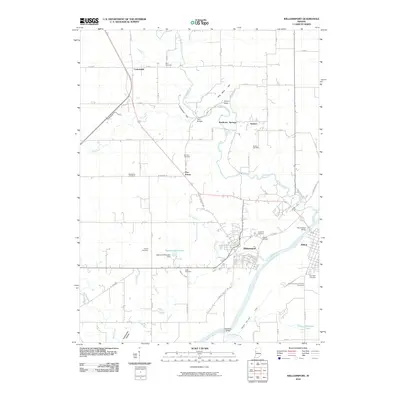
2010 Map of Williamsport
USGS Topo · Published 2010About this map
The Wabash River and its historic transportation corridors anchor this 2010 study of West-Central Indiana. In the river’s sweeping bend, the town of Williamsport and the nearby city of Attica are connected by the Paul Dresser Bridge, while the preserved path of the Wabash and Erie Canal remains visible on the southern bank. This geography reflects a layered history of commerce, from early nineteenth-century waterways to modern state roads.
Find a feature on this map
59 named features on this map. Tap any name to fly to it.
Don’t see what you’re looking for? This feature index may not catch every label — zoom into the map to look around manually.
Map Details
Editions of this 2010 Williamsport Map
This is the sole edition of this map. No revisions or reprints were ever made.
Other maps of this area

1953 · Danville
USGS Topo · 1:250,000

1955 · Danville
USGS Topo · 1:250,000

1956 · Danville
USGS Topo · 1:250,000

1958 · Stonebluff
USGS Topo · 1:24,000
1958 · Covington
USGS Topo · 1:24,000

1961 · Chatterton
USGS Topo · 1:24,000

1961 · Tab
USGS Topo · 1:24,000

1961 · Pine Village
USGS Topo · 1:24,000

1961 · West Lebanon
USGS Topo · 1:24,000

1962 · Williamsport
USGS Topo · 1:24,000