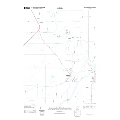
2013 Map of Williamsport
USGS Topo · Published 2013About this map
Williamsport and Attica anchor this landscape where the Wabash River carves a deep valley through western Indiana. The map captures a high degree of topographic detail along the river bluffs, notably around Lovers Leap and Hog Back Hill. Historically significant features include the trace of the Wabash and Erie Canal south of the river and the site of Mudlavia Springs near Kramer. The drainage patterns are well-defined by numerous tributaries such as Big Pine Cr, Fall Cr, and the channelized French Ditch. Further inland, small rural settlements like Carbondale and Five Points are shown connected by an extensive network of county roads. The transition from the flat agricultural plains to the dissected river valley is evident, particularly where the Shawnee Bridge and Shawnee Lake sit along the river's southern banks.
Find a feature on this map
102 named features on this map. Tap any name to fly to it.
Don’t see what you’re looking for? This feature index may not catch every label — zoom into the map to look around manually.
Map Details
Editions of this 2013 Williamsport Map
This is the sole edition of this map. No revisions or reprints were ever made.
Other maps of this area

1953 · Danville
USGS Topo · 1:250,000

1955 · Danville
USGS Topo · 1:250,000

1956 · Danville
USGS Topo · 1:250,000

1958 · Stonebluff
USGS Topo · 1:24,000
1958 · Covington
USGS Topo · 1:24,000

1961 · Chatterton
USGS Topo · 1:24,000

1961 · Tab
USGS Topo · 1:24,000

1961 · Pine Village
USGS Topo · 1:24,000

1961 · West Lebanon
USGS Topo · 1:24,000

1962 · Williamsport
USGS Topo · 1:24,000