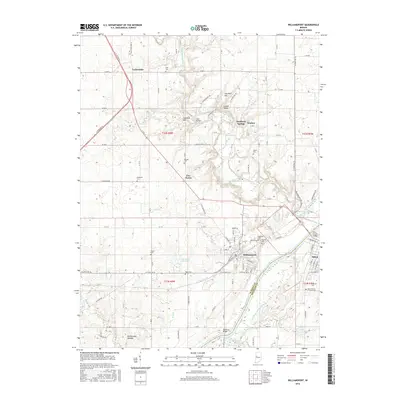
2016 Map of Williamsport
USGS Topo · Published 2016About this map
The Wabash River forms a major geographic boundary between Warren County and Fountain County, anchoring the settlements of Williamsport and Attica. This river corridor is a focal point of local history, where the legacy of nineteenth-century transportation is still visible in the traces of the Wabash and Erie Canal. The landscape north of the river is defined by the winding course of Big Pine Creek, which flows past landmarks like Lovers Leap and Hog Back Hill near the small communities of Mudlavia Springs and Kramer.
Find a feature on this map
111 named features on this map. Tap any name to fly to it.
Don’t see what you’re looking for? This feature index may not catch every label — zoom into the map to look around manually.
Map Details
Editions of this 2016 Williamsport Map
This is the sole edition of this map. No revisions or reprints were ever made.
Other maps of this area

1953 · Danville
USGS Topo · 1:250,000

1955 · Danville
USGS Topo · 1:250,000

1956 · Danville
USGS Topo · 1:250,000

1958 · Stonebluff
USGS Topo · 1:24,000
1958 · Covington
USGS Topo · 1:24,000

1961 · Chatterton
USGS Topo · 1:24,000

1961 · Tab
USGS Topo · 1:24,000

1961 · Pine Village
USGS Topo · 1:24,000

1961 · West Lebanon
USGS Topo · 1:24,000

1962 · Williamsport
USGS Topo · 1:24,000