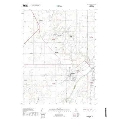
2019 Map of Williamsport
USGS Topo · Published 2019About this map
The Wabash River carves a deep valley between Williamsport and Attica in this modern topographic study of the Indiana borderlands. The landscape is defined by the legacy of early transit and industry, most notably the visible trace of the Wabash and Erie Canal running parallel to the river. Genealogists will find a high concentration of burial grounds throughout the area, including Hillside Cem, Riverside Cem, and the Saint Francis of Xavier Cem, alongside several family-named sites like Goodwine Cem and McCabe Cem. The terrain north of the river features striking natural landmarks such as Lovers Leap and Copeland Hill, while the historic health resort of Mudlavia Springs sits near the small settlement of Kramer. The mapping also documents contemporary water features like Desmond Able Lake and the various tributaries including Big Pine Creek and French Ditch that feed into the Wabash valley.
Find a feature on this map
110 named features on this map. Tap any name to fly to it.
Don’t see what you’re looking for? This feature index may not catch every label — zoom into the map to look around manually.
Map Details
Editions of this 2019 Williamsport Map
This is the sole edition of this map. No revisions or reprints were ever made.
Other maps of this area

1953 · Danville
USGS Topo · 1:250,000

1955 · Danville
USGS Topo · 1:250,000

1956 · Danville
USGS Topo · 1:250,000

1958 · Stonebluff
USGS Topo · 1:24,000
1958 · Covington
USGS Topo · 1:24,000

1961 · Chatterton
USGS Topo · 1:24,000

1961 · Tab
USGS Topo · 1:24,000

1961 · Pine Village
USGS Topo · 1:24,000

1961 · West Lebanon
USGS Topo · 1:24,000

1962 · Williamsport
USGS Topo · 1:24,000