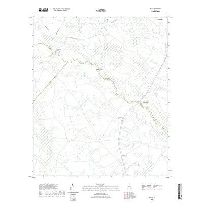
2020 Map of Willie
USGS Topo · Published 2020About this map
The Canoochee River carves a winding path through this corner of southeastern Georgia, defining the borders where Bryan, Evans, and Liberty counties meet. The small settlement of Willie serves as a central point in a landscape marked by family-named landmarks and water-bound terrain. Riverside features such as Edwards Rocks, Simmons Point, and Clifton Bluff highlight the unique topography of the river corridor, while Brushy Island sits in the wetlands to the north. For those tracing local lineage, the map provides precise locations for several burial grounds, including Jerusalem Cem, Salem Cem, and Strum Bay Cem. The road network, including Moody Bridge Rd and Leroy Field Rd, connects these rural points, crossing the water at Moodys Bridge near the northwest corner of the survey.
Find a feature on this map
28 named features on this map. Tap any name to fly to it.
Don’t see what you’re looking for? This feature index may not catch every label — zoom into the map to look around manually.
Map Details
Editions of this 2020 Willie Map
This is the sole edition of this map. No revisions or reprints were ever made.
Other maps of this area

1918 · Hinesville
USGS Topo · 1:62,500

1919 · Claxton
USGS Topo · 1:62,500

1920 · Pembroke
USGS Topo · 1:62,500

1920 · Glennville
USGS Topo · 1:62,500

1944 · Claxton
USGS Topo · 1:62,500

1944 · Glennville
USGS Topo · 1:62,500

1944 · Hinesville
USGS Topo · 1:62,500

1946 · Brunswick
USGS Topo · 1:250,000

1947 · Savannah
USGS Topo · 1:250,000

1948 · Brunswick
USGS Topo · 1:250,000