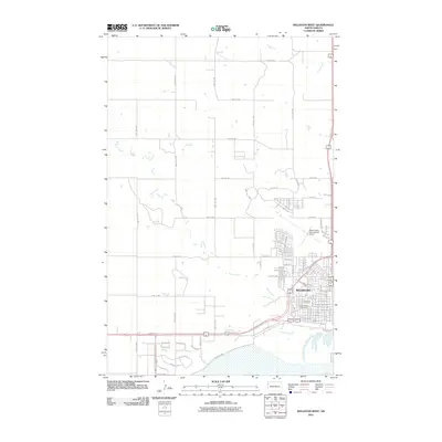
2011 Map of Williston West
USGS Topo · Published 2011About this map
Williston's western development and its vital aviation and drainage infrastructure define this 2011 survey of the North Dakota landscape. The map centers on the urban grid expanding westward, where the Sloulin Field International Airport occupies a prominent plateau north of the residential core. This era shows the organized growth of the city with street names like Bison Dr and Crest St pushing into the formerly agricultural outskirts. The terrain is deeply influenced by the winding paths of Sand Creek and Camp Creek, which carve natural drainage patterns across the high plains. For those interested in local heritage, the map clearly identifies established grounds such as Riverview Cemetery and Saint Joseph Cemetery, located near the southern bend of the creek. The road network, including County Hwy-7 and various section-line roads like 57th St NW, illustrates the geometric transition from a rural township to an industrial and residential hub.
Find a feature on this map
50 named features on this map. Tap any name to fly to it.
Don’t see what you’re looking for? This feature index may not catch every label — zoom into the map to look around manually.
Map Details
Editions of this 2011 Williston West Map
This is the sole edition of this map. No revisions or reprints were ever made.
Other maps of this area

1953 · Williston
USGS Topo · 1:250,000

1957 · Williston
USGS Topo · 1:250,000

1959 · Marmon SE
USGS Topo · 1:24,000

1959 · Williston West
USGS Topo · 1:24,000

1959 · Williston East
USGS Topo · 1:24,000

1969 · Trenton
USGS Topo · 1:24,000

1974 · Otter Tail Creek
USGS Topo · 1:24,000

1974 · Trenton NE
USGS Topo · 1:24,000
1974 · Bonetraill SE
USGS Topo · 1:24,000
1979 · Williston SE
USGS Topo · 1:24,000