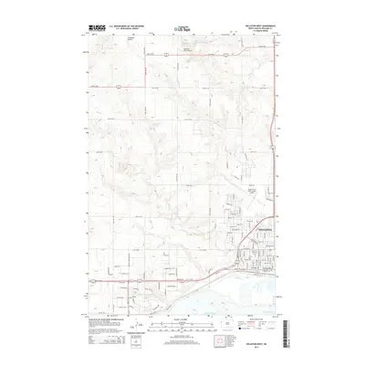
2014 Map of Williston West
USGS Topo · Published 2014About this map
Williston serves as the focal point for this western North Dakota landscape, where the Missouri River plateau transitions toward the northern reaches of Lake Sakakawea. The map reveals a community organized around a strict grid of streets and avenues, with Us-2 and W Front St anchoring the southern corridor near the water. On the western edge of the city, Riverview Cem and Saint Joseph Cem provide specific points of interest for genealogists tracking local family histories.
Find a feature on this map
51 named features on this map. Tap any name to fly to it.
Don’t see what you’re looking for? This feature index may not catch every label — zoom into the map to look around manually.
Map Details
Editions of this 2014 Williston West Map
This is the sole edition of this map. No revisions or reprints were ever made.
Other maps of this area

1953 · Williston
USGS Topo · 1:250,000

1957 · Williston
USGS Topo · 1:250,000

1959 · Marmon SE
USGS Topo · 1:24,000

1959 · Williston West
USGS Topo · 1:24,000

1959 · Williston East
USGS Topo · 1:24,000

1969 · Trenton
USGS Topo · 1:24,000

1974 · Otter Tail Creek
USGS Topo · 1:24,000

1974 · Trenton NE
USGS Topo · 1:24,000
1974 · Bonetraill SE
USGS Topo · 1:24,000
1979 · Williston SE
USGS Topo · 1:24,000