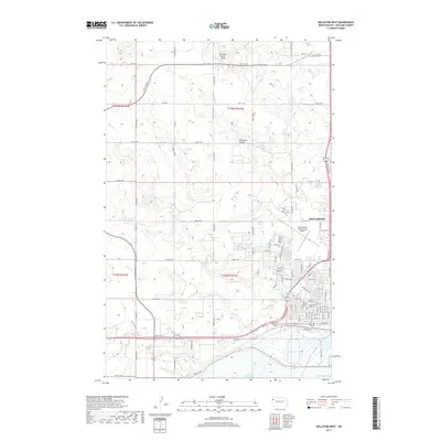
2017 Map of Williston West
USGS Topo · Published 2017About this map
The western edges of Williston meet the vast waters of Lake Sakakawea in this detailed 2017 study of the North Dakota landscape. The map illustrates a city expanding into the prairie, with residential grids like Bison Dr and Riverside Dr reaching toward the Missouri River's flooded valley. This transition from urban development to rural ranching is marked by local aviation hubs, including Sloulin Field International Airport near the city center and the Ring Rock Ranch Airport to the north.
Find a feature on this map
49 named features on this map. Tap any name to fly to it.
Don’t see what you’re looking for? This feature index may not catch every label — zoom into the map to look around manually.
Map Details
Editions of this 2017 Williston West Map
This is the sole edition of this map. No revisions or reprints were ever made.
Other maps of this area

1953 · Williston
USGS Topo · 1:250,000

1957 · Williston
USGS Topo · 1:250,000

1959 · Marmon SE
USGS Topo · 1:24,000

1959 · Williston West
USGS Topo · 1:24,000

1959 · Williston East
USGS Topo · 1:24,000

1969 · Trenton
USGS Topo · 1:24,000

1974 · Otter Tail Creek
USGS Topo · 1:24,000

1974 · Trenton NE
USGS Topo · 1:24,000
1974 · Bonetraill SE
USGS Topo · 1:24,000
1979 · Williston SE
USGS Topo · 1:24,000