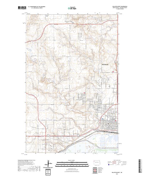
2024 Map of Williston West
USGS Topo · Published 2024About this map
Williston expands across the western edge of the city and into the surrounding plains in this modern topographic survey. The landscape is defined by the drainage systems of Sand Creek and Chinaman Coulee, which carve through the high ground north of the Missouri River valley. The map reveals the organized grid of the urban center transitioning into rural sections, marked by key infrastructure such as the Ring Rock Ranch Airport and a central Post Office. For those tracing local heritage, the map identifies significant burial sites including Riverview Cem and Saint Joseph Cem, situated near the developed corridors of the town. The network of county roads like Co HWY 6 and numbered streets shows the continued growth and connectivity of this Williams County hub, balancing its residential development with the vast open spaces of the northern plains.
Find a feature on this map
110 named features on this map. Tap any name to fly to it.
Don’t see what you’re looking for? This feature index may not catch every label — zoom into the map to look around manually.
Map Details
Editions of this 2024 Williston West Map
This is the sole edition of this map. No revisions or reprints were ever made.
Other maps of this area

1953 · Williston
USGS Topo · 1:250,000

1957 · Williston
USGS Topo · 1:250,000

1959 · Marmon SE
USGS Topo · 1:24,000

1959 · Williston West
USGS Topo · 1:24,000

1959 · Williston East
USGS Topo · 1:24,000

1969 · Trenton
USGS Topo · 1:24,000

1974 · Otter Tail Creek
USGS Topo · 1:24,000

1974 · Trenton NE
USGS Topo · 1:24,000
1974 · Bonetraill SE
USGS Topo · 1:24,000
1979 · Williston SE
USGS Topo · 1:24,000