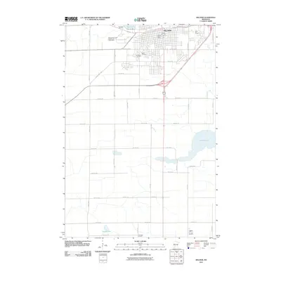
2010 Map of Willmar
USGS Topo · Published 2010About this map
Willmar serves as a significant regional hub in central Minnesota, shown here with its grid of residential and commercial streets anchored by the Willmar Post Office. The landscape is defined by its numerous water bodies, including Foot Lake and its associated Foot Lake Dam near the town center, while the larger Lake Wakanda and Stevens Lake lie to the south and east. A strong connection to local heritage is evident in the preservation of several burial grounds such as Hardanger Cemetery, Saint Marys Cemetery, and Bethel Cemetery. To the south, the small community of Svea marks a distinct rural settlement point. The map also captures the local transportation and recreation infrastructure, from the Willmar Municipal Airport-John L Rice Field to the Valley Golf Course, illustrating the development of the county seat and its outlying farming communities at the turn of the 21st century.
Find a feature on this map
45 named features on this map. Tap any name to fly to it.
Don’t see what you’re looking for? This feature index may not catch every label — zoom into the map to look around manually.
Map Details
Editions of this 2010 Willmar Map
This is the sole edition of this map. No revisions or reprints were ever made.
Other maps of this area

1953 · New Ulm
USGS Topo · 1:250,000

1953 · Saint Cloud
USGS Topo · 1:250,000

1956 · Atwater
USGS Topo · 1:62,500

1957 · Saint Cloud
USGS Topo · 1:250,000

1957 · New Ulm
USGS Topo · 1:250,000

1957 · Olivia
USGS Topo · 1:62,500

1958 · New Ulm
USGS Topo · 1:250,000

1958 · Saint Cloud
USGS Topo · 1:250,000

1958 · Raymond
USGS Topo · 1:24,000

1958 · Pennock
USGS Topo · 1:24,000