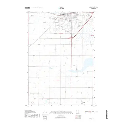
2019 Map of Willmar
USGS Topo · Published 2019About this map
Willmar serves as the regional hub in this modern survey, showing a detailed street grid defined by major arteries like Litchfield Ave SE and Willmar Ave SW. The town's infrastructure is anchored by the Willmar Municipal Airport-John L Rice Field and an expanding industrial corridor along Industrial Dr SW. Water features including Foot Lake and Lake Wakanda punctuate the landscape, illustrating the proximity of the residential core to the natural glacial basin topography of the area.
Find a feature on this map
54 named features on this map. Tap any name to fly to it.
Don’t see what you’re looking for? This feature index may not catch every label — zoom into the map to look around manually.
Map Details
Editions of this 2019 Willmar Map
This is the sole edition of this map. No revisions or reprints were ever made.
Other maps of this area

1953 · New Ulm
USGS Topo · 1:250,000

1953 · Saint Cloud
USGS Topo · 1:250,000

1956 · Atwater
USGS Topo · 1:62,500

1957 · Saint Cloud
USGS Topo · 1:250,000

1957 · New Ulm
USGS Topo · 1:250,000

1957 · Olivia
USGS Topo · 1:62,500

1958 · New Ulm
USGS Topo · 1:250,000

1958 · Saint Cloud
USGS Topo · 1:250,000

1958 · Raymond
USGS Topo · 1:24,000

1958 · Pennock
USGS Topo · 1:24,000