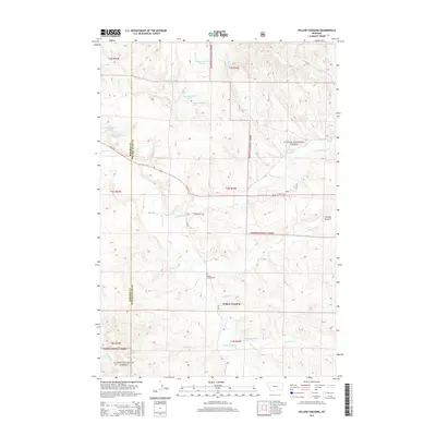
2014 Map of Willow Crossing
USGS Topo · Published 2014About this map
Custer National Forest dominates much of this southeastern Montana landscape, where the high plains meet the intricate drainage systems of the Otter Cr valley. The map centers on the small community of Willow Crossing, a hub defined by the intersection of Us-212 and local routes like the Ponderosa Trl. This area in Powder River Co and Rosebud Co reveals a landscape managed for water and livestock, evidenced by numerous named springs and reservoirs such as Daily Reservoir and Lower Coal Cr Reservoir.
Find a feature on this map
41 named features on this map. Tap any name to fly to it.
Don’t see what you’re looking for? This feature index may not catch every label — zoom into the map to look around manually.
Map Details
Editions of this 2014 Willow Crossing Map
This is the sole edition of this map. No revisions or reprints were ever made.
Other maps of this area

1954 · Hardin
USGS Topo · 1:250,000

1957 · Hardin
USGS Topo · 1:250,000

1958 · Hardin
USGS Topo · 1:250,000

1966 · Coleman Draw
USGS Topo · 1:24,000

1966 · Ashland
USGS Topo · 1:24,000

1966 · Beaver Creek School
USGS Topo · 1:24,000

1966 · Cook Creek Reservoir
USGS Topo · 1:24,000

1966 · King Mountain
USGS Topo · 1:24,000

1966 · Willow Crossing
USGS Topo · 1:24,000

1966 · Ashland NE
USGS Topo · 1:24,000