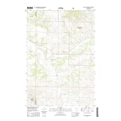
2017 Map of Willow Crossing
USGS Topo · Published 2017About this map
Custer National Forest lands dominate much of this landscape in Powder River County, where the settlement of Willow Crossing stands near the confluence of Home Cr and Otter Cr. The map reveals a land managed for water and transit, defined by several reservoirs including Willow Cr Reservoir, Lower Coal Cr Reservoir, and Daily Reservoir. Genealogists and local historians can locate the Willow Crossing Cem situated just west of the main settlement area. The terrain is marked by distinctive drainages such as Thomas Draw and Cook Cr, while the boundary between Rosebud Co and Powder River Co runs vertically through the western sections. Local transit is traced via Otter Creek Rd and Stevens Rd, which connect the scattered ranching or agricultural sites typical of this Montana region.
Find a feature on this map
32 named features on this map. Tap any name to fly to it.
Don’t see what you’re looking for? This feature index may not catch every label — zoom into the map to look around manually.
Map Details
Editions of this 2017 Willow Crossing Map
This is the sole edition of this map. No revisions or reprints were ever made.
Other maps of this area

1954 · Hardin
USGS Topo · 1:250,000

1957 · Hardin
USGS Topo · 1:250,000

1958 · Hardin
USGS Topo · 1:250,000

1966 · Coleman Draw
USGS Topo · 1:24,000

1966 · Ashland
USGS Topo · 1:24,000

1966 · Beaver Creek School
USGS Topo · 1:24,000

1966 · Cook Creek Reservoir
USGS Topo · 1:24,000

1966 · King Mountain
USGS Topo · 1:24,000

1966 · Willow Crossing
USGS Topo · 1:24,000

1966 · Ashland NE
USGS Topo · 1:24,000