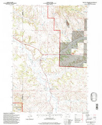
1995 Map of Willow Crossing
USGS Topo · Published 1998About this map
Willow Crossing sits along the winding path of Otter Creek, serving as a central point in this landscape of eastern Montana during the mid-1990s. The settlement's history is anchored by the Willow Crossing Cem, while the surrounding terrain across the Rosebud Co and Powder River Co line shows a distinct reliance on water management and resource extraction. Numerous small reservoirs, including Willow Creek Reservoir and Daily Reservoir, are scattered throughout the draws to support ranching or local industry in this semi-arid environment.
Find a feature on this map
33 named features on this map. Tap any name to fly to it.
Don’t see what you’re looking for? This feature index may not catch every label — zoom into the map to look around manually.
Map Details
Editions of this 1995 Willow Crossing Map
This is the sole edition of this map. No revisions or reprints were ever made.
Other maps of this area

1954 · Hardin
USGS Topo · 1:250,000

1957 · Hardin
USGS Topo · 1:250,000

1958 · Hardin
USGS Topo · 1:250,000

1966 · Coleman Draw
USGS Topo · 1:24,000

1966 · Ashland
USGS Topo · 1:24,000

1966 · Beaver Creek School
USGS Topo · 1:24,000

1966 · Cook Creek Reservoir
USGS Topo · 1:24,000

1966 · King Mountain
USGS Topo · 1:24,000

1966 · Willow Crossing
USGS Topo · 1:24,000

1966 · Ashland NE
USGS Topo · 1:24,000