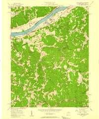
1957 Map of Willow Island
USGS Topo · Published 1958About this map
The Ohio River corridor defines this 1957 landscape, serving as a busy industrial and transportation artery where the Baltimore and Ohio railroad skirts the riverbank. On the West Virginia side, the prominent Willow Island and its associated substation represent the era's infrastructure, while the surrounding hills are dotted with a high density of oil wells. This industrial presence contrasts with the deeply dissected terrain of the interior, where ridge-top life is evidenced by family and community landmarks like Middle Ridge and Pumpkin Knob.
Find a feature on this map
56 named features on this map. Tap any name to fly to it.
Don’t see what you’re looking for? This feature index may not catch every label — zoom into the map to look around manually.
Map Details
Editions of this 1957 Willow Island Map
3 editions found
Other maps of this area

1904 · Marietta
USGS Topo · 1:62,500

1906 · Saint Marys
USGS Topo · 1:62,500

1906 · Elizabeth
USGS Topo · 1:62,500

1907 · Harrisville
USGS Topo · 1:62,500

1924 · St Marys
USGS Topo · 1:62,500

1924 · Harrisville
USGS Topo · 1:62,500

1924 · Marietta
USGS Topo · 1:62,500

1924 · Elizabeth
USGS Topo · 1:62,500

1926 · Elizabeth
USGS Topo · 1:62,500

1926 · Harrisville
USGS Topo · 1:62,500