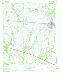
1962 Map of Wills Point
USGS Topo · Published 1982About this map
Wills Point serves as the primary hub of activity in this northeast Texas landscape, defined by its position along the Texas and Pacific railroad line. The town's local infrastructure is well-documented, from the Cartwright High Sch and the municipal Filtration Plant to the Rodeo Ground near the northern tracks. Beyond the town limits, the terrain transitions into a patchwork of rural homesteads and agricultural tracts drained by waterways like Rocky Cedar Creek and McBee Creek. Small rural communities such as Hiram and Cobb appear alongside significant family and community landmarks, including Union Grove Cem and New Salem Cem. The 1980s-era purple revisions reveal urban expansion and road developments around the Wills Point Reservoir, illustrating the town's growth decades after the original 1962 survey.
Find a feature on this map
31 named features on this map. Tap any name to fly to it.
Don’t see what you’re looking for? This feature index may not catch every label — zoom into the map to look around manually.
Map Details
Editions of this 1962 Wills Point Map
2 editions found
Other maps of this area

1954 · Dallas
USGS Topo · 1:250,000

1956 · Tyler
USGS Topo · 1:250,000

1956 · Quinlan
USGS Topo · 1:62,500

1956 · Emory
USGS Topo · 1:62,500

1958 · Dallas
USGS Topo · 1:250,000

1962 · Myrtle Springs
USGS Topo · 1:24,000

1962 · Elmo
USGS Topo · 1:24,000

1962 · Cedarvale
USGS Topo · 1:24,000

1962 · Wills Point
USGS Topo · 1:24,000
1962 · Ola
USGS Topo · 1:24,000