1949 Map of Wilson
USGS Topo · Published 1979About this map
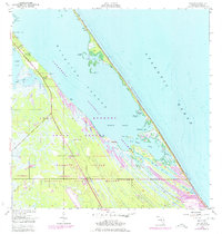
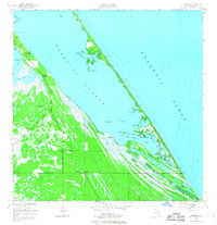
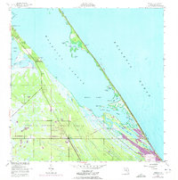
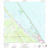
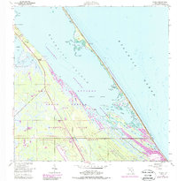
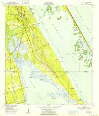
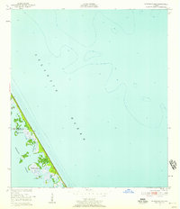
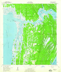
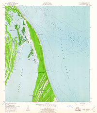
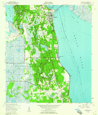
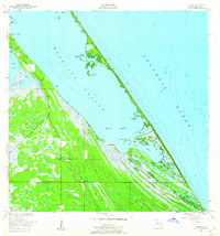
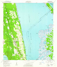
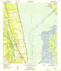
Merritt Island serves as a critical junction of early Florida citrus cultivation and the dawn of the space age. This survey, based on 1940s data with later revisions, shows the transition of the northern reach of the John F Kennedy Space Center (NASA) as it began to overlay older coastal settlements. While the US Government RR and Kennedy Parkway represent modern infrastructure, traces of the previous era remain at Wilson and Dummit Grove. The map details the intricate waterways between the Atlantic Ocean and Mosquito Lagoon, including Max Hoeck Creek and Gallinipper Basin. To the south, the massive footprints of Launch Complex 39 and Launch Complex 39B contrast sharply with the pristine environments of the Merritt Island National Wildlife Refuge and the long, undeveloped stretch of Klondike Beach.
Find a feature on this map
42 named features on this map. Tap any name to fly to it.
Don’t see what you’re looking for? This feature index may not catch every label — zoom into the map to look around manually.
Map Details
Editions of this 1949 Wilson Map
6 editions found
Other maps of this area
1949 · Oak Hill
USGS Topo · 1:24,000
1949 · Pardon Island
USGS Topo · 1:24,000
1949 · Orsino
USGS Topo · 1:24,000
1949 · False Cape
USGS Topo · 1:24,000
1949 · Titusville
USGS Topo · 1:24,000
1949 · Wilson
USGS Topo · 1:24,000
1949 · Mims
USGS Topo · 1:24,000

1951 · False Cape
USGS Topo · 1:24,000

1951 · Orsino
USGS Topo · 1:24,000
1952 · Mims
USGS Topo · 1:24,000