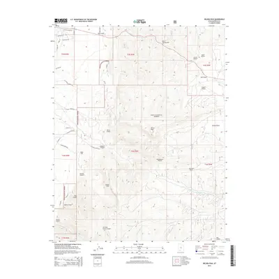
2014 Map of Wilson Peak
USGS Topo · Published 2014About this map
Dixie National Forest dominates this high-altitude landscape in Garfield County, where the dramatic elevation shifts of the Paunsaugunt Plateau define the terrain. The map highlights a series of deep drainages and cliffs, including the prominent Sunset Cliffs and the rugged cuts of Red Canyon and Wilson Canyon. Historically significant landmarks like Butch Cassidy Draw and Coyote Hollow speak to the area's heritage of livestock grazing and frontier lore. Water sources are primarily concentrated in the south, with the headwaters of Blue Fly Cr and its various forks carving through the silt and stone. The road network, including E Hillsdale Cemetery Rd and S Scenic Dr, provides access to the higher peaks such as Wilson Peak, illustrating the 21st-century infrastructure used to navigate this remote section of the Colorado Plateau.
Find a feature on this map
43 named features on this map. Tap any name to fly to it.
Don’t see what you’re looking for? This feature index may not catch every label — zoom into the map to look around manually.
Map Details
Editions of this 2014 Wilson Peak Map
This is the sole edition of this map. No revisions or reprints were ever made.
Other maps of this area

1886 · Kanab
USGS Topo · 1:250,000

1953 · Cedar City
USGS Topo · 1:250,000

1958 · Cedar City
USGS Topo · 1:250,000

1962 · Cedar City
USGS Topo · 1:250,000

1966 · Wilson Peak
USGS Topo · 1:24,000
1966 · Bryce Canyon
USGS Topo · 1:24,000

1966 · Hatch
USGS Topo · 1:24,000

1966 · George Mtn
USGS Topo · 1:24,000
1966 · Tropic Reservoir
USGS Topo · 1:24,000
1966 · Bryce Point
USGS Topo · 1:24,000