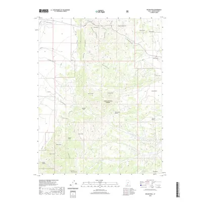
2020 Map of Wilson Peak
USGS Topo · Published 2020About this map
Right Fork Blue Fly Cr flows through the drainages of Garfield County in this 2020 topographic survey of the area surrounding Wilson Peak. The landscape is defined by the high-elevation Paunsaugunt Plateau, where the drainage network of the Colorado River basin has carved a complex system of canyons and cliffs. This map documents the hydrologic patterns and topography of the Dixie National Forest, showing how water moves through the high desert terrain. For researchers and geographers, the detailed contour lines and named water features provide a precise record of the physical geography of this part of southern Utah in the early twenty-first century.
Find a feature on this map
1 named feature on this map. Tap any name to fly to it.
Don’t see what you’re looking for? This feature index may not catch every label — zoom into the map to look around manually.
Map Details
Editions of this 2020 Wilson Peak Map
This is the sole edition of this map. No revisions or reprints were ever made.
Other maps of this area

1886 · Kanab
USGS Topo · 1:250,000

1953 · Cedar City
USGS Topo · 1:250,000

1958 · Cedar City
USGS Topo · 1:250,000

1962 · Cedar City
USGS Topo · 1:250,000

1966 · Wilson Peak
USGS Topo · 1:24,000
1966 · Bryce Canyon
USGS Topo · 1:24,000

1966 · Hatch
USGS Topo · 1:24,000

1966 · George Mtn
USGS Topo · 1:24,000
1966 · Tropic Reservoir
USGS Topo · 1:24,000
1966 · Bryce Point
USGS Topo · 1:24,000