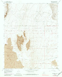
1952 Map of Wind Mesa
USGS Topo · Published 1984About this map
Isleta Pueblo Indian Land and the surrounding Pajarito Grant comprise this mid-century topographic study, defined by the stark volcanic geology of Wind Mesa. The landscape is dominated by extensive Lava flows that create high plateaus and distinct landforms like Blackbird Hill. Surveyed primarily in the early 1950s, the map reveals a sparsely developed territory where infrastructure is limited to essential markers of the ranching and industrial economy.
Find a feature on this map
12 named features on this map. Tap any name to fly to it.
Don’t see what you’re looking for? This feature index may not catch every label — zoom into the map to look around manually.
Map Details
Editions of this 1952 Wind Mesa Map
3 editions found
Other maps of this area

1888 · Bernalillo
USGS Topo · 1:125,000

1889 · Albuquerque
USGS Topo · 1:125,000

1893 · Albuquerque
USGS Topo · 1:125,000

1934 · West Albuquerque
USGS Topo · 1:24,000

1938 · Albuquerque
USGS Topo · 1:62,500

1952 · Wind Mesa
USGS Topo · 1:24,000

1952 · Dalies
USGS Topo · 1:24,000

1952 · Rio Puerco
USGS Topo · 1:24,000

1952 · Los Lunas
USGS Topo · 1:24,000

1952 · Isleta
USGS Topo · 1:24,000