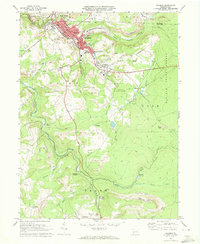
1971 Map of Windber
USGS Topo · Published 1973About this map
The industrial and natural landscape of Somerset and Cambria counties unfolds around Windber, showing a region defined by its coal-mining history and timber resources. Active and former extraction sites are marked by numerous mine dumps and strip mines that sit adjacent to residential areas like Scalp Level and Rummel. The Penn Central railroad tracks follow the winding course of Paint Creek, illustrating the vital link between the mineral-rich hills and the transport networks of the 1970s.
Find a feature on this map
52 named features on this map. Tap any name to fly to it.
Don’t see what you’re looking for? This feature index may not catch every label — zoom into the map to look around manually.
Map Details
Editions of this 1971 Windber Map
4 editions found
Other maps of this area

1902 · Ebensburg
USGS Topo · 1:62,500

1904 · Ebensburg
USGS Topo · 1:62,500

1904 · Johnstown
USGS Topo · 1:62,500

1907 · Johnstown
USGS Topo · 1:62,500

1908 · Bedford
USGS Topo · 1:62,500

1910 · Bedford
USGS Topo · 1:62,500

1914 · Windber
USGS Topo · 1:62,500

1916 · Windber
USGS Topo · 1:62,500

1944 · Windber
USGS Topo · 1:62,500

1953 · Pittsburgh
USGS Topo · 1:250,000