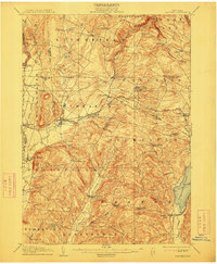
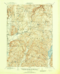
1907 Map of Winfield
USGS Topo · Published 1913About this map
West Winfield and the surrounding villages of Plainfield and Exeter define this region of central New York at the turn of the century. The landscape is a network of small, specialized settlements and family-named crossroads like Cranes Corners and Goodiers Corners. This period showcases the height of the local railway era, with the Delaware Lackawanna and Western R. R. and the Otsego and Herkimer Electric R. R. connecting rural milk-producing hamlets to regional hubs.
Find a feature on this map
71 named features on this map. Tap any name to fly to it.
Don’t see what you’re looking for? This feature index may not catch every label — zoom into the map to look around manually.
Map Details
Editions of this 1907 Winfield Map
6 editions found
Other maps of this area

1895 · Oriskany
USGS Topo · 1:62,500

1898 · Utica
USGS Topo · 1:62,500

1898 · Oriskany
USGS Topo · 1:62,500

1900 · Little Falls
USGS Topo · 1:62,500

1900 · Utica
USGS Topo · 1:62,500

1903 · Richfield Springs
USGS Topo · 1:62,500

1903 · Little Falls
USGS Topo · 1:62,500

1907 · Winfield
USGS Topo · 1:62,500

1907 · Sangerfield
USGS Topo · 1:62,500

1907 · Cooperstown
USGS Topo · 1:62,500