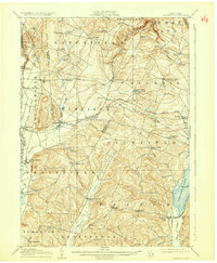
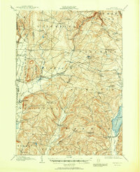
1907 Map of Winfield
USGS Topo · Published 1932About this map
The Unadilla River and its various branches define the geography of this central New York region at the turn of the century. The map highlights a complex network of small rural hamlets and post offices, such as Columbia Center and East Winfield, which served as local social and economic anchors before the age of modern consolidation. Transportation is dominated by the Delaware Lackawanna and Western R R, which established key stops at Millers Mills Station and Cedarville Station, facilitating the movement of goods and people through the varied terrain. Notable water bodies like Canadarago Lake and the smaller Summit Lake are prominent, while family-named corners such as Goodiers Corners and Denison Corners provide critical reference points for genealogists tracing ancestral property. The map also records the precise administrative boundaries between Herkimer and Otsego counties, illustrating how these political lines intersected with the natural flow of the Wharton Creek drainage.
Find a feature on this map
68 named features on this map. Tap any name to fly to it.
Don’t see what you’re looking for? This feature index may not catch every label — zoom into the map to look around manually.
Map Details
Editions of this 1907 Winfield Map
6 editions found
Other maps of this area

1895 · Oriskany
USGS Topo · 1:62,500

1898 · Utica
USGS Topo · 1:62,500

1898 · Oriskany
USGS Topo · 1:62,500

1900 · Little Falls
USGS Topo · 1:62,500

1900 · Utica
USGS Topo · 1:62,500

1903 · Richfield Springs
USGS Topo · 1:62,500

1903 · Little Falls
USGS Topo · 1:62,500

1907 · Winfield
USGS Topo · 1:62,500

1907 · Sangerfield
USGS Topo · 1:62,500

1907 · Cooperstown
USGS Topo · 1:62,500