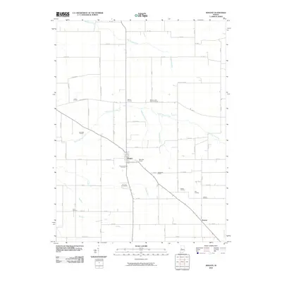
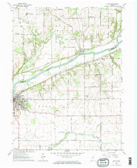
2010 Map of Wingate
USGS Topo · Published 2010About this map
Wingate and Elmdale serve as the primary focal points of this 2010 USGS topographic survey, situated within a productive agricultural landscape defined by an extensive grid of county roads. The terrain is drained by several watercourses including Big Shawnee Creek in the north and the North Fork Coal Creek which meanders through the central section. The area's drainage is further managed by the Charles Ludlow Ditch and Joseph Ludlow Ditch, reflecting the managed hydrology of Indiana farmland.
Find a feature on this map
68 named features on this map. Tap any name to fly to it.
Don’t see what you’re looking for? This feature index may not catch every label — zoom into the map to look around manually.
Map Details
Editions of this 2010 Wingate Map
This is the sole edition of this map. No revisions or reprints were ever made.
Other maps of this area

1953 · Danville
USGS Topo · 1:250,000

1955 · Danville
USGS Topo · 1:250,000

1956 · Danville
USGS Topo · 1:250,000

1956 · Crawfordsville
USGS Topo · 1:24,000

1958 · Linden
USGS Topo · 1:24,000

1961 · Romney
USGS Topo · 1:24,000
1962 · Waynetown
USGS Topo · 1:24,000
1962 · Mellott
USGS Topo · 1:24,000
1962 · Westpoint
USGS Topo · 1:24,000
1962 · Attica
USGS Topo · 1:24,000