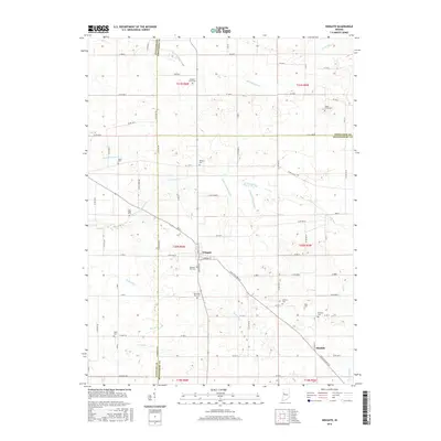
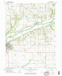
2016 Map of Wingate
USGS Topo · Published 2016About this map
The town of Wingate stands as the central hub of this West Central Indiana landscape, where the borders of Montgomery, Fountain, and Tippecanoe Counties converge. The topography is defined by an intricate network of agricultural drainage and natural waterways, including the winding N Fork Coal Cr and Turkey Run. Family history is deeply rooted in the numerous rural burial grounds scattered throughout the townships, such as Meharry Cem, Wheeler Grove Cem, and Pleasant Hill Cem. To the southeast, the small settlement of Elmdale marks a junction near Clarison Ditch. The map illustrates a mature rural grid system where local roads like N Mountain Rd and Co Rd 800 W connect isolated farmsteads and historic family-named landmarks. This survey provides a precise look at the drainage infrastructure that reclaimed this fertile land, noted by the presence of the Joseph Ludlow Ditch and Charles Ludlow Ditch.
Find a feature on this map
86 named features on this map. Tap any name to fly to it.
Don’t see what you’re looking for? This feature index may not catch every label — zoom into the map to look around manually.
Map Details
Editions of this 2016 Wingate Map
This is the sole edition of this map. No revisions or reprints were ever made.
Other maps of this area

1953 · Danville
USGS Topo · 1:250,000

1955 · Danville
USGS Topo · 1:250,000

1956 · Danville
USGS Topo · 1:250,000

1956 · Crawfordsville
USGS Topo · 1:24,000

1958 · Linden
USGS Topo · 1:24,000

1961 · Romney
USGS Topo · 1:24,000
1962 · Waynetown
USGS Topo · 1:24,000
1962 · Mellott
USGS Topo · 1:24,000
1962 · Westpoint
USGS Topo · 1:24,000
1962 · Attica
USGS Topo · 1:24,000