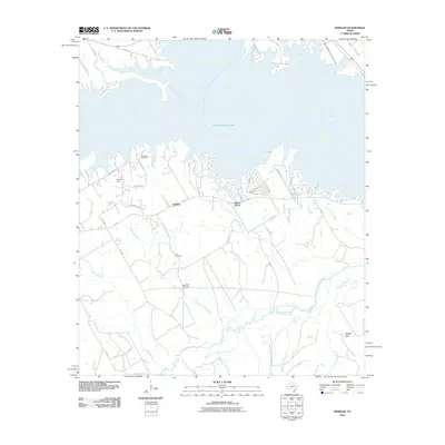
2010 Map of Winkler
USGS Topo · Published 2010About this map
Texas Industries Lake dominates the northern landscape of this Navarro County quadrangle, where the irregular shoreline meets a network of rural roads and creek drainages. The settlements of Winkler and Saint Elmo sit along FM 416, serving as local focal points for a region defined by its natural resources and family heritage. Genealogists will find several burial grounds across the area, including Sweatman Cemetery near the lake and Lee Cemetery further south.
Find a feature on this map
35 named features on this map. Tap any name to fly to it.
Don’t see what you’re looking for? This feature index may not catch every label — zoom into the map to look around manually.
Map Details
Editions of this 2010 Winkler Map
This is the sole edition of this map. No revisions or reprints were ever made.
Other maps of this area

1954 · Dallas
USGS Topo · 1:250,000

1954 · Waco
USGS Topo · 1:250,000

1955 · Waco
USGS Topo · 1:250,000

1958 · Dallas
USGS Topo · 1:250,000

1959 · Powell
USGS Topo · 1:24,000

1960 · Winkler
USGS Topo · 1:24,000

1960 · Streetman
USGS Topo · 1:24,000

1960 · Creslenn Ranch
USGS Topo · 1:24,000

1960 · Goodlow Park
USGS Topo · 1:24,000

1960 · Roustabout Camp
USGS Topo · 1:24,000