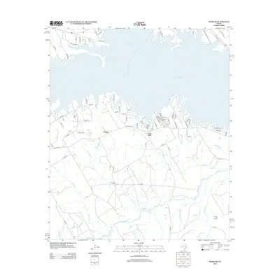
2013 Map of Winkler
USGS Topo · Published 2013About this map
The community of Winkler and the nearby settlement of Saint Elmo anchor this 2013 survey of the Navarro County landscape, where the northern horizon is dominated by the waters of Lake Corsicana and Texas Industries Lake. The terrain south of the lakes is a network of creek drainages, including Tehuacana Cr, Greenbriar Cr, and Spring Br, which carve through the countryside. For those researching local history or genealogy, the map identifies several burial grounds, such as Sweatman Cem, Lee Cem, and Greenbriar Cem, often located near these small watercourses.
Find a feature on this map
78 named features on this map. Tap any name to fly to it.
Don’t see what you’re looking for? This feature index may not catch every label — zoom into the map to look around manually.
Map Details
Editions of this 2013 Winkler Map
This is the sole edition of this map. No revisions or reprints were ever made.
Other maps of this area

1954 · Dallas
USGS Topo · 1:250,000

1954 · Waco
USGS Topo · 1:250,000

1955 · Waco
USGS Topo · 1:250,000

1958 · Dallas
USGS Topo · 1:250,000

1959 · Powell
USGS Topo · 1:24,000

1960 · Winkler
USGS Topo · 1:24,000

1960 · Streetman
USGS Topo · 1:24,000

1960 · Creslenn Ranch
USGS Topo · 1:24,000

1960 · Goodlow Park
USGS Topo · 1:24,000

1960 · Roustabout Camp
USGS Topo · 1:24,000