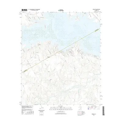
2016 Map of Winkler
USGS Topo · Published 2016About this map
Winkler serves as the central hub of this survey along the border of Navarro Co and Freestone Co. The landscape is defined by the transition from the rolling drainage basins of Tehuacana Creek and Greenbriar Cr in the south to the massive water bodies of Lake Corsicana and Texas Industries Lake in the north. This modern era study reveals a mix of old rural heritage and newer residential developments, particularly around The Shores Dr and Midway Landing Rd. Genealogists will find significant value in the distribution of family and community burial grounds, such as Petersburg Cem, Lee Cem, and the hyphenated Sweatman - Blackmon Cem. The map illustrates how local infrastructure, including FM 416 and State Hwy 309, connects these water-side communities while preserving the historical footprints of small rural settlements.
Find a feature on this map
73 named features on this map. Tap any name to fly to it.
Don’t see what you’re looking for? This feature index may not catch every label — zoom into the map to look around manually.
Map Details
Editions of this 2016 Winkler Map
This is the sole edition of this map. No revisions or reprints were ever made.
Other maps of this area

1954 · Dallas
USGS Topo · 1:250,000

1954 · Waco
USGS Topo · 1:250,000

1955 · Waco
USGS Topo · 1:250,000

1958 · Dallas
USGS Topo · 1:250,000

1959 · Powell
USGS Topo · 1:24,000

1960 · Winkler
USGS Topo · 1:24,000

1960 · Streetman
USGS Topo · 1:24,000

1960 · Creslenn Ranch
USGS Topo · 1:24,000

1960 · Goodlow Park
USGS Topo · 1:24,000

1960 · Roustabout Camp
USGS Topo · 1:24,000