1918 Map of Winterroad
USGS Topo · Published 1943About this map
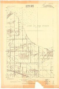
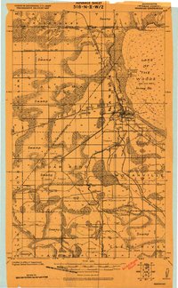
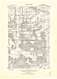
Clear River and the Warroad River anchor this landscape during a period of massive hydrological transformation along the Roseau and Beltrami county line. The map illustrates an extensive drainage network, where the natural flow is intercepted by the Main Judicial Ditch No 62 and Judicial Ditch No 23, alongside dozens of numbered laterals and branches. This engineered system was designed to reclaim the boggy terrain of Oak Myre and the surrounding wilderness for settlement and agriculture.
Find a feature on this map
39 named features on this map. Tap any name to fly to it.
Don’t see what you’re looking for? This feature index may not catch every label — zoom into the map to look around manually.
Map Details
Editions of this 1918 Winterroad Map
2 editions found
Other maps of this area

1918 · Winterroad
USGS Topo · 1:62,500

1918 · Roosevelt
USGS Topo · 1:62,500

1918 · F
USGS Topo · 1:62,500
1918 · Williams
USGS Topo · 1:62,500
1918 · Warroad
USGS Topo · 1:62,500

1918 · Malcolm
USGS Topo · 1:62,500
1919 · Peppermint Creek
USGS Topo · 1:62,500
1919 · G
USGS Topo · 1:62,500
1943 · Peppermint Creek
USGS Topo · 1:62,500

1943 · Roosevelt
USGS Topo · 1:62,500