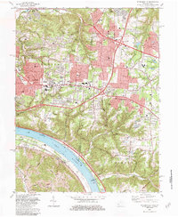
1983 Map of Withamsville
USGS Topo · Published 1984About this map
Suburban development and traditional riverfront landscapes meet where the Ohio River curves past New Palestine and Melbourne. By the early 1980s, the growing communities of Withamsville, Cherry Grove, and Forestville show a dense network of residential streets and educational institutions such as Anderson High Sch and St Veronicas Sch. The landscape is defined by its deep creek beds, including Clough Creek, Fivemile Creek, and Tenmile Creek, which carve through the hilly terrain of Anderson and Union townships.
Find a feature on this map
64 named features on this map. Tap any name to fly to it.
Don’t see what you’re looking for? This feature index may not catch every label — zoom into the map to look around manually.
Map Details
Editions of this 1983 Withamsville Map
4 editions found
Other maps of this area

1898 · East Cincinnati
USGS Topo · 1:62,500

1914 · East Cincinnati
USGS Topo · 1:62,500

1914 · Batavia
USGS Topo · 1:48,000

1916 · Batavia
USGS Topo · 1:62,500

1929 · Alexandria
USGS Topo · 1:48,000

1931 · Felicity
USGS Topo · 1:62,500

1936 · Alexandria
USGS Topo · 1:62,500

1952 · Newport
USGS Topo · 1:24,000

1953 · Laurel
USGS Topo · 1:24,000

1953 · Withamsville
USGS Topo · 1:24,000