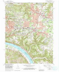
1983 Map of Withamsville
USGS Topo · Published 1992About this map
The Ohio River curves along the southern edge of this landscape, separating the developing suburbs of Clermont County from the Kentucky shorelines of Melbourne and Camp Springs. In the early 1980s, the area transitioned from the industrial activity of the Gravel Pit near Newtown to the burgeoning residential clusters of Cherry Grove and Withamsville. The map documents a high density of religious and educational institutions, including the St Gregory Seminary, Sacred Heart Seminary, and several parochial schools like St Veronica Sch.
Find a feature on this map
64 named features on this map. Tap any name to fly to it.
Don’t see what you’re looking for? This feature index may not catch every label — zoom into the map to look around manually.
Map Details
Editions of this 1983 Withamsville Map
4 editions found
Other maps of this area

1898 · East Cincinnati
USGS Topo · 1:62,500

1914 · East Cincinnati
USGS Topo · 1:62,500

1914 · Batavia
USGS Topo · 1:48,000

1916 · Batavia
USGS Topo · 1:62,500

1929 · Alexandria
USGS Topo · 1:48,000

1931 · Felicity
USGS Topo · 1:62,500

1936 · Alexandria
USGS Topo · 1:62,500

1952 · Newport
USGS Topo · 1:24,000

1953 · Laurel
USGS Topo · 1:24,000

1953 · Withamsville
USGS Topo · 1:24,000